
Loading...
Loading...
Mariana County
September 23, 2026 at 07:32 AM
Hedged the unconfirmed county position and the regions it is thought to contain, corrected the reading of the trailer road sign, hedged neighbor directions, trimmed a series generalization, and fixed missing commas
Mariana County is a county in the State of Leonida in Grand Theft Auto VI, most likely in the south of the state. Rockstar has not published a county map, but the county is thought to stretch from the mainland wetlands down through the island chain of the Leonida Keys, which would give it some of the most varied terrain in the state. That landscape ranges from flooded sawgrass plains and dense mangrove forests to tropical island communities connected by causeways.
Mariana County was first revealed in Trailer 2, where its name appears on an Interstate 404 directional sign in the Port Gellhorn area, listed alongside Vice-Dale County. The sign points east, so Mariana County lies somewhere east of Port Gellhorn along the interstate. Its placement in the south, covering the Grassrivers and the Keys, follows the real-world Monroe County parallel and has not been confirmed by Rockstar.
Mariana County is defined by two major sub-regions that together account for most of its landmass and character.
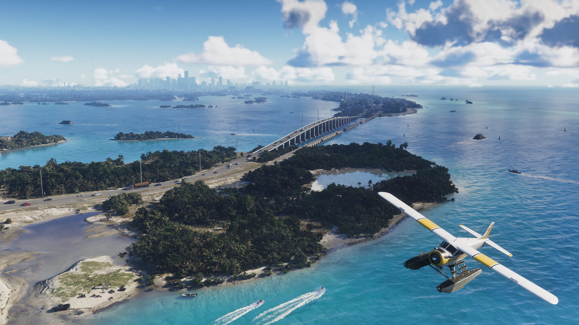
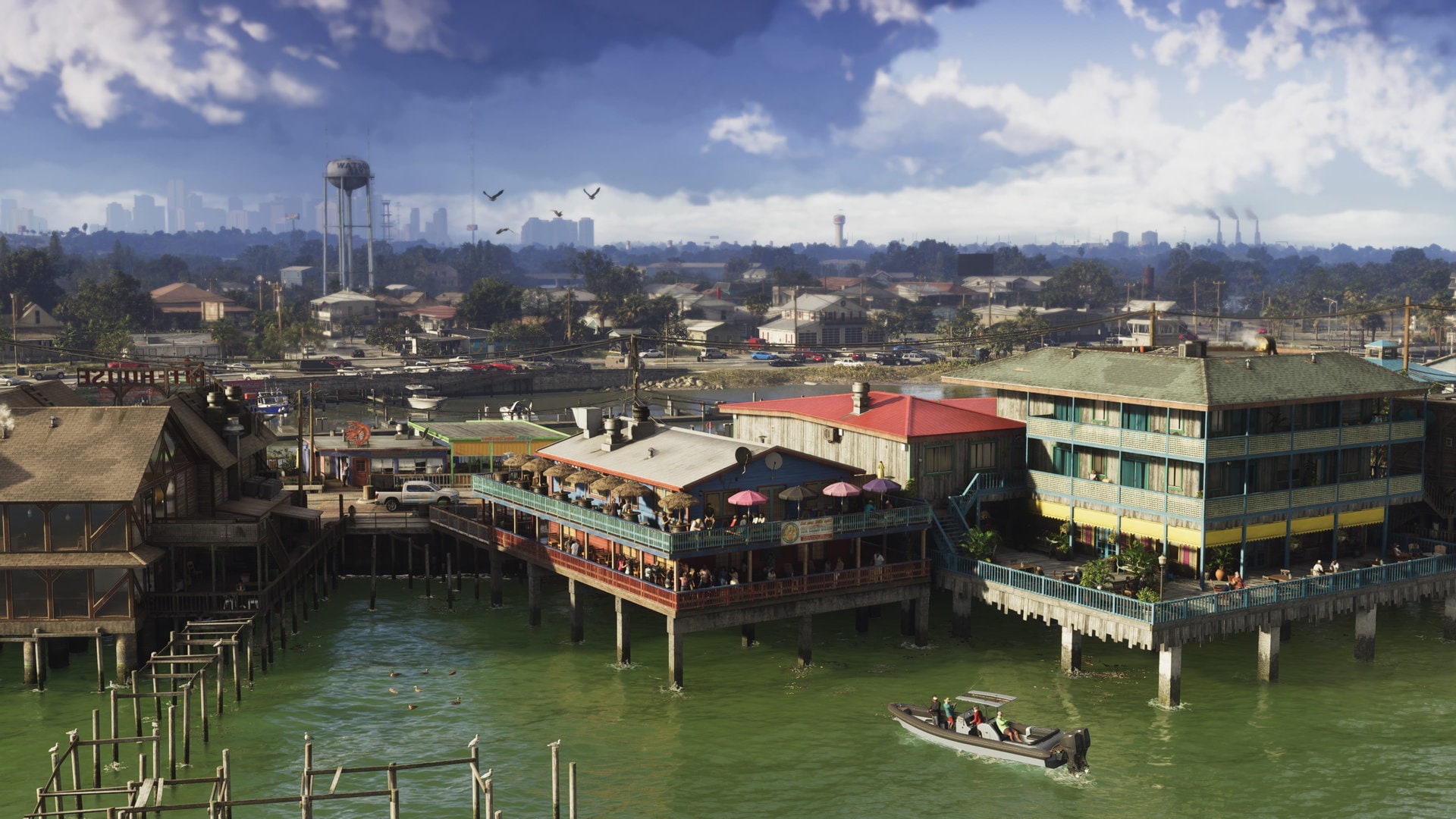
If the county follows its real-world model, the Grassrivers would occupy its northern and central sections. This vast expanse of flooded grasslands, mangrove channels, and muddy waterways is Leonida's equivalent of the real-world Florida Everglades. The region is home to dangerous wildlife including alligators, snakes, and other predators. Small settlements dot the edges of the wetlands, including the waterfront town of Watson Bay, which sits on the Grassrivers coastline.
The Grassrivers terrain is largely inaccessible by conventional road vehicles making airboats, swamp buggies, and boats the primary means of transportation through the interior. Unpaved trails and elevated boardwalks connect a handful of isolated structures, fishing camps, and docks scattered across the wetlands.
The Leonida Keys form an archipelago running off Leonida's southern coast and are thought to belong to Mariana County, stretching into the Gulf of Mexico and the Straits of Leonida. The island chain is accessible via the Keys Causeway, which connects to southern Vice-Dale County. The Keys feature tropical resort communities, marinas, and waterfront bars, providing a stark contrast to the untamed Grassrivers to the north.
The most notable settlement in the Keys is Key Lento, a small island town that is a popular destination for tourists and locals alike. The Keys are inspired by the real-world Florida Keys, which lie within Monroe County off the southern tip of Florida.
Mariana County is primarily based on Monroe County, Florida, which encompasses the Florida Keys, the Everglades National Park, and several small mainland communities. The county name may also draw from Marion County, Florida.
Monroe County is one of the southernmost counties in the continental United States and is known for its unique geography, stretching from the Everglades on the mainland through the chain of islands that make up the Florida Keys. This same structure is reflected in Mariana County's combination of the Grassrivers wetlands and the Leonida Keys.
Rockstar has not published a county map, so the directions below are approximate.
Direction | County | Notes |
|---|---|---|
North | Rural and agricultural county in northwestern Leonida | |
East | Primary metropolitan county containing Vice City; connected via the Keys Causeway to the south | |
Northeast | Inland industrial county centered on sugar production |
Interstate 404 runs through or near Mariana County, connecting it to Vice-Dale County and Kelly County. Within the county, a network of smaller roads serves the Grassrivers communities, while the Keys Causeway provides the primary route south to the Leonida Keys. Boats and watercraft play an important role in navigating the Grassrivers, where paved roads are scarce.
Detail | Information |
|---|---|
Based on | Monroe County, Florida (name possibly from Marion County) |
Location in Leonida | Probably southern Leonida (unconfirmed) |
Associated sub-regions | Grassrivers and Leonida Keys (unconfirmed) |
First revealed | Trailer 2 (Interstate 404 road sign) |
Associated settlements | Watson Bay and Key Lento (unconfirmed) |
Primary highway | Interstate 404 |